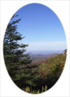
Natures Beauty

Sunday, January 13, 2008

Winged Deer Park ..... Johnson City, Tennessee


Winged Deer Park
Johnson City, Tennessee


Wing Deer Park has a lot to offer everyone. It is a 200 acre park that features one of the region's best softball / soccer facilities. It also has a fitness track, 1 1/2 miles of wooded nature trails, 9-hole disc golf course, and open picnic tables. At the lakefront (Boone Lake) you can fish or stroll along the lighted boardwalk and enjoy sand volleyball.

To Visit Winged Deer Park:
Take I-81 S.to 381 N. (Hwy.11E) towards Bristol.
Winged Deer Park is located on the left just before the DeVault Bridge.

Cherokee Lake.....Rogersville, Tennessee


Cherokee Lake
Rogersville, Tennessee

I guess by now you have figured out that I enjoy being at the lake.
Cherokee Lake covers many counties in Tennessee but my favorite place to be on this lake is in Rogersville. It seems that I have taken some of my better photographs in this area.
If you would like to visit this area of Cherokee Lake:
(From the town of Rogersville)
Turn LEFT onto LEE HWY/US-11W/TN-1/TN-70.
Continue to follow LEE HWY/US-11W S/TN-1 W.

There are many pull offs on this road to access the lake.

Panther Creek State Park .....Morristown, Tennessee


Panther Creek State Park
Morristown, Tennessee


Panther Creek Park is a rustic park with 1,400 + acres of land.
The park is mostly a wooded area that sits along side the Cherokee Lake.
The land at one time was considered a part of "The Great Cherokee Hunting Ground" and below the waters of the Cherokee Lake lies the Great Indian Warpath once followed by Daniel Boone.
Legend has it that Panther Creek received its names from Colonel Bradley of Virgina while exploring the area he shot a panther that fell into the spring thus the name Pather Creek.

If you are looking for a place to get away from the hustle and bustle of everyday life you have found it here. Visitors can use many of the trails for hiking, biking, and horseback riding. You can go fishing, or camping and the children will enjoy the pool or playground. This area is a great recreational spot for everyone.
To Visit Panther Creek Park:
(From the North)
I-81 take exit 12 (Hwy160)
Travel North on 160 to Hwy. 11E,
turn right and then take the next left.
The park is 2.5 miles on the right.

Laurel Run Park.....Church Hill, Tennessee


Laurel Run Park
Church Hill, Tennessee


Laurel Run Park is a really nice place to relax.
It is located on the Holston River. It is a mostly a nature park but has a playground, picnic areas, walking track, basketball courts, and more.
The movie "The River " starring Mel Gibson and Sissy Spacek was filmed on this location.
Much of the movie was on this 440 acres of land purchased by Universal Studios. It was then cleared and turned into working farms in four weeks for the movie. Universal Studios then turned over the land to the city and is now known as Laurel Run Park.
To Visit Laurel Run Park:
(From Rogersville)
Take US 11 W to Goshen Valley Road,
(This road will be on the right)
Go .8 miles and turn left onto Smith Road.
Travel 2 miles and turn left onto Laurel Run Road.
Follow the road out and arrive at park.

Fall Creek Marina & Campground .....Russellville, Tennessee


Fall Creek Marina & Campground/
Cherokee Lake
Russellville, Tennessee
Fall Creek is a full service marina and camp ground open year around.
The Cherokee Lake is a great place for any fisherman and a nice place to take the family for a picnic, or swim .
To Find Fall Creek Marina & Campground:
I-81 to Hwy. 25 N.
Exit #8;
5 miles to Hwy. 11-E
3rd Morristown Exit turn toward Greeneville,
5 miles to Russellville.
Left Three Springs Rd 1 mile to Fall Creek Rd ,
1 mile to Fall Creek Dock Rd.
½ mile to Marina & Campgrounds.

Cades Cove..... Blount County, Tennessee


Cades Cove
Blount County,Tennessee
Cades Cove is one of the most visited areas in the Great Smokey Mountains.
It is a sampler of everything the park has to offer. Cades cove is abundant with wild life. It also offers visitors horseback and hiking trails, fishing, camping, history, photography at its best, etc.
Cades Cove is best seen via Cades Cove Loop which is a one way paved road that skirts the bottom of the mountain . Traffic will be heavy in the summer, fall, and all weekends. While driving through the area you will find pioneer churches, cemeteries, farms, fields, trails and roads. You will leave feeling like you have stepped back in time.
Cades Cove was once known as "Kate's Cove" after a Indian chiefs wife. The cove was abundant with wildlife that later brought European descent frontiersman to the area. They cleared off the valley floor and built a community to sustain them. The families stayed in the area until it became apart of The Great Smokey Mountains. The cove was preserved to look much like it did in the 1800's.
For those of you that enjoy waterfalls as much as I do make sure to take the trail leading to Abrams Falls.
To get to Cades Cove:
(From the north)
Take I-75 to Knoxville.
Take I-40 east to exit 407.
Turn right onto S.R. 66.
Continue until the first major intersection in Sevierville.
Turn left onto U.S. 411 and follow 411 to S.R. 416.
Turn right on S.R. 416 and follow until you reach U.S. 321.
Turn right onto U.S. 321 south and west and continue until you reach Gatlinburg.
Continue through Gatlinburg.
From light #1,
it is less than a mile to the Park entrance and the Sugarland Visitors Center.

Viking Mountain.....Greeneville, Tennessee


Viking Mountain
Greeneville, Tennessee
Viking Mountain is a wonderful place to visit any time of the
year but offers the best views in the autumn season when the colors
are astounding.
Viking Mountain is also known as Camp Creek Bald. It is 4844' above sea level and is a part of the Cherokee National Forest. It is one of the highest mountains in East Tennessee. The Mountain is easily seen up to 50 miles from the base of the mountain. There are very few locations in Greeneville that can not see Viking Mountain.
Viking Mountain was once a ski resort in the early 70's that buzzed
with activity. Now Viking Mountain is home to hunters, hikers, photographers, and nature lovers alike.
***Warning***
If hiking in this area please be careful. The area is abundant with bear.
To Visit Viking Mountain:
From Greeneville take TN 70 S,
Follow TN 70 S 14.8 miles to Viking Mountain Road,
Turn right onto Viking Mountain Road and follow signs.

Round Knob Summit Greeneville, Tennessee


Round Knob Summit
Greeneville, Tennessee
Round Knob is one of my favorite places to go in Greeneville.
Round Knob is 3,258 feet above sea level and offers many breath taking views.
At the end of the Round Knob access road you will find a
very nice area to have a picnic. The pavilion offers picnic tables along with
a fireplace that can be used on cooler days. Outside the pavilion is a grill and
two extra picnic tables for visitors use.
The history of Round Knob lingers after the war of the states (1861- 1864).
Round Knob was originally owned by William Jennings a confederate sympathizer,
the land was taken from Mr. Jennings in a post Civil War lawsuit.
The area then was known as Buck's Mountain for about
50 years after its new owner Buck Moncier.
To Get to Round Knob:
From Greeneville take TN 350 S to the Camp Creek community
and continue on the country road for about 2 miles. Turn right onto
Forest Road 88 and travel 5 miles . The road dead ends at the Round Knob Pavilion.

Saturday, January 12, 2008

Meadow View Fire Tower .....Cocke County


Meadow Creek Fire Tower
Newport, Tennessee

At the start of the autumn season a friend brought me to the
Meadow Creek Fire Tower. The views are so beautiful that words can't describe.
The Fire Tower overlooks Cocke and Greene County.
Meadow Creek Fire Tower is a part of the
Cherokee National Forest and HoustonValley Recreational Area.
The tower is 1 of the 6 remaining towers in the Cherokee National Forest.

To Visit Meadow View Fire Tower.....
From Greeneville, Tennessee take TN 70 S about 10 miles,
Turn right onto TN 107 W,
Pass the Houston Valley Rec. parking area,
Drive until you find Forest Road on the right.
This is the access road to the fire tower.
Stay start until you dead in.
Park and take the small trail on your right which leads to the tower.